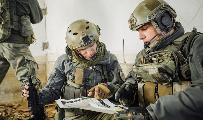
Reading a military map is not as hard as most people assume. If you do not know how to read a military map yet, this is the article for you. We will show you all the steps with a military map example and talk about the military map symbols in detail.
The two methods that will cover in this article are:
- Estimate direct distances on a map grid
- Measure direct distances using a scale
Table of Contents
What You Will Need
- Military map
- Pencil
- Coordinate scale
- Ruler, compass, RA protractor, or a sheet of paper
Map Reading Army Class – Army Military Map Reading

1. Understand the basics of the military map
Before you can dive into any reading, you will need to know the basic components that you will encounter.
Military maps have grids, which are essentially two sets of parallel lines.
- One set is called Eastings. It runs from the South to the North with numbers increasing Eastwards.
- The other set is called Northings. It goes from the West to the East with numbers rising Northwards.
The sets of lines form small squares called grid squares. The squares are numbered, which starts from the bottom left-hand corner.
The numbers make up the digits in coordinates, and this is what specifies a point location.
You will also need to familiarize yourself with the Military Grid Reference System.
The abbreviation for this is MGRS. It is the NATO standard system. You can use it on all of the operational mapping and navigation systems, except on Irish and British maps.
There are three parts:
- 6 figure grid reference
- 100 km grid square letters
- Grid zone designator
The 100 km grid square letters and the grid zone designator can be found in the map margin box as follows:
For the 100 km reference, you must:
- Read the large numbers on the vertical grid line from the left of the point and estimate tenths from the grid line to the point.
- Read the large numbers on the horizontal grid line below the point and estimate tenths from the grid line to the point.
For example, this sample 1,000 km grid square would be 047 162.
For the 1000,000 km square identification, make the prefix where the point lies.
In this example, the identification is NS.
For the grid zone designator, make the prefix when reporting outside the grid zone designator.
These three parts together, give us the full grid reference. In our case, it is 32R NS 047162.
Maps are made on many different scales. Scale is the ratio between the distance on the map and the same distance on the ground. It is shown as both a ratio and a scale bar at the bottom of the map, typically.
Note: Modern maps may display the scale as a fraction or a statement on the top of the map. For example, 1/50,000 or “2cm equals 1 km” respectively.
Tactical military scales are usually 1:50,000 and 1:1000,0000. In operation maps, there can also be scales of 1:10,000 and 1:500.
Maps will also illustrate contours.
- Contour spacing indicates slopes. Slopes can be even, concave, convex, or irregular.
- Contour pattern indicates the shape of the ground. It can be hills, ridges, saddles, valleys, re-entrants, and spurs/draws.
2. Choose your approach to reading the map
When you read a map army, you can either
- Estimate direct distances on a map grid
- Measure direct distances using a scale
For this approach, you can use a ruler, compass, RA protractor, or a sheet of paper to help you.
- Measure the distance between the places marked on the map
- Compare the measurement you get with the scale given
- Convert it to get the actual (real-life) distance
This is easy with straight lines. But with curves, it will be a bit trickier. You can do the same; the only difference is that you will have to go by sections or bits. For example:
3. Read using method #1
Usually, military grid maps contain 6 digit grid coordinates, but this is not always the case. Here is how to read grid references, regardless of the number of digit coordinates present.
- Read the figures from left to right
This means you will read the figures along the Eastings lines.
- Read the figures from the bottom to top
This means you will read the figures along the Northings lines.
One way to remember this: along the corridor and up the stairs! It is ALWAYS Eastings and then Northings.
Let’s try this example. We need to get the coordinate for Southwest Corner:
- Read from the left to the right. You will arrive at 11.
- Read from the bottom to the top. You will arrive at 81.
So, Southwest Corner is at 1181.
Now, to get more precise, pretend that each grid square has 10 Easting lines and 10 Northings lines. As a result, you get 100 smaller squares.
You want to get the point at the end of the black line in the same example:
- You will go halfway between 11 and 12. So, add 5 to your previous 11.
- You will go 3/10 of the way between 81 and 82. So, add 3 to your previous 81.
Hence, the point is at 115813.
4. Read with method #2
When you read grid coordinates on a military map this way, you cannot get the optimal accuracy so for exact coordinates, you will need to use a coordinate scale.
Here is what you have to do:
- Identify the grid square where the point is located
- The 1st and 2nd coordinate digits are the number of the vertical grid line on the left side of the grid square
- The 4th and 5th coordinate digits are the number of the horizontal grid line on the South or bottom side of the grid square
- Set the scale on the bottom horizontal grid line of the grid square to get the 3rd and 6th coordinate digits
- Check that the 0s of the coordinate scale are in the lower left-hand of the grid square
- Glide the scale to the right but keep the scale’s bottom on the bottom grid line
- Glide until the point is under the right-hand scale
- The 100-meter mark closest to the vertical grid line gives you the 3rd digit
- The 100-meter mark closest to the point gives you the 6th digit
So, our exact coordinate is 115813.
- Look at the grid reference box to identify the two-letter 100,000 km identifier
- The 100,000 km identifier is placed in front of the coordinate
Ours is GL. So, it is GL 11508133.
Conclusion
As you have finished reading this article on “How to read a military map?” you should now be able to quickly and easily comprehend military maps. Apply what you have learned in this article and practice until you are content with your map-reading abilities.
If you have any further questions or thoughts, please reach out to us in the comments below, and if you think this can benefit a friend, please share it with them. Thank you (so much) in advance!

I am Everett Bledsoe, taking on the responsibility of content producer for The Soldiers Project. My purpose in this project is to give honest reviews on the gear utilized and tested over time. Of course, you cannot go wrong when checking out our package of information and guide, too, as they come from reliable sources and years of experience.